Collision Diagram Roadway Layout Module (Item# A-17)
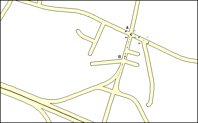
Figure A-17A: Collision Diagram Roadway Layout Module Sample Output
Features:
·
AIMS can generate a roadway layout map from your centerline
GIS map, or we can use your layout map.
·
You can plot both intersection and mid-block collision
diagrams directly on a map with roadway layout.
·
Mid-block collisions are plotted at locations relative to
the distances or mileposts. Intersection collisions are plotted at the
intersection.
·
To plot them, you can select locations from the map, from a
list, or type the locations out.
·
You can select locations from the map by drawing one or more
areas of any shapes on the map.
·
You can zoom-in to see the collision diagram in detail. You
can zoom out to see the roadway layout of the surrounding areas.
·
Figure A-17A is a zoom-out view. It shows the roadway layout
of the surrounding areas. The collision diagrams may appear as dots and lines
in this view.
·
The collision diagrams are sharp and clear when you zoom-in,
because they are plotted in vector format.
·
You can zoom-in more between locations A and B to see more
details of the collisions, as shown in Figure A-17B.
·
Figure A-17C is a zoom-in view at intersection A. It shows a
typical intersection collision diagram.
·
Figure A-17D is a zoom-in view around location B. It shows a
typical mid-block collision diagram.
·
Figure A-17E plots collisions at intersection A only. It
shows a more zoom-out view of intersection A than that of Figure A-17C. It
shows more roadway layout of the surrounding than that of Figure A-17C. (Note:
Figure A-17C and Figure A-17E show the same intersection, however, Figure A-17C
has more zoom-in level than Figure 17A-E.)
·
You can plot collision diagrams for up to a hundred
intersections and mid-block locations.
·
You can label each collision with any or all of the
following: date, time, day of week, weather, pavement condition, accident
identification number, vehicle travel directions and collision type. (The label
will look like Figure A-02 in Collision Diagram Module.)
·
If you order the Accident Report Image Module (Item A-11),
when you click a plotted symbol, AIMS will display the scanned accident report
image corresponding to the plotted symbol (see Figure A-11A).
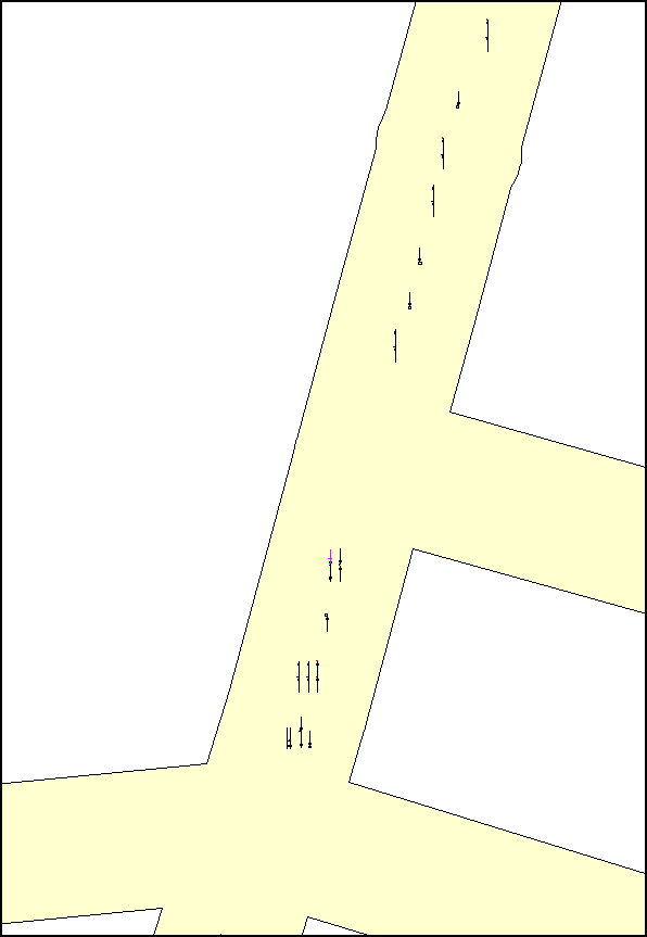
Figure A-17B: Mid-Block Collision Diagrams With Roadway Layout (Zoom-in View Between A and B of
Figure A-17A)
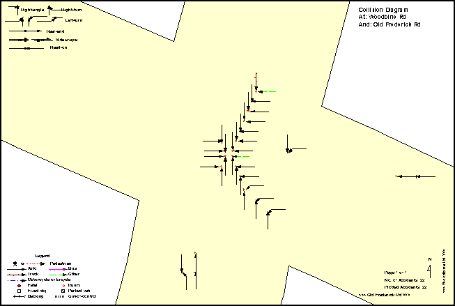
Figure A-17C: Intersection Collision Diagram With Roadway Layout (Zoom-in View of Location A in Figure A-17A)
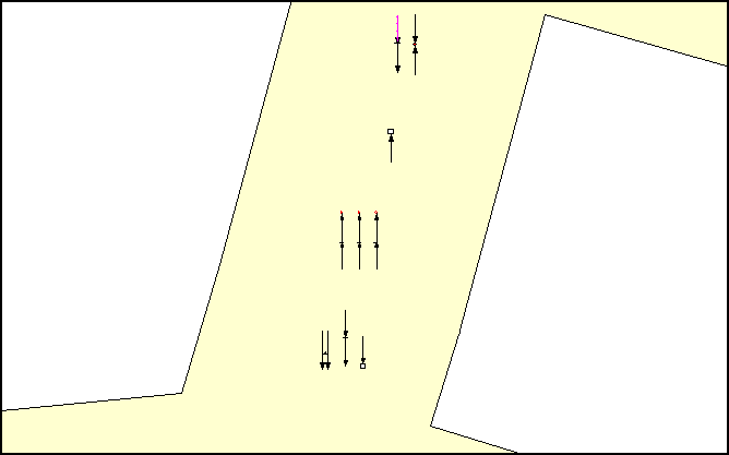
Figure A-17D: Mid-Block Collision Diagram With Roadway Layout (Zoom-in View of Location B in Figure A-17A)
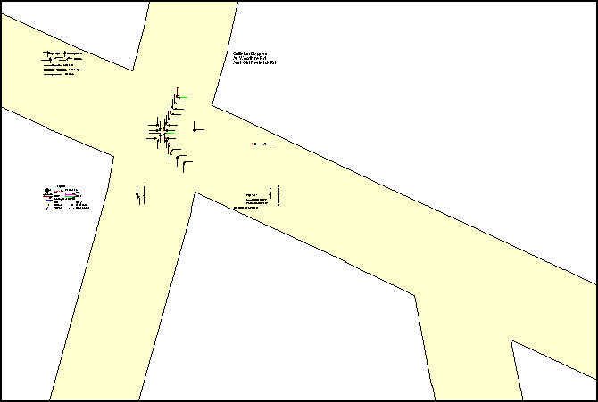
Figure A-17E: Plotting Collisions for Intersection A Only, With A More Zoom-Out View Than Figure A-17C,
Showing More Roadway Layout Of The Surrounding Than FigureA-17C
| Home AIMS AIMS-Internet About Us Contact |
| Copyright © 2023, JMW Engineering, Inc. All rights reserved. Protected by U.S. Patent 6104410 |