ArcGIS
Interface Module (Item# A-15)
Features:
·
AIMS interfaces with ESRI’s ArcGIS version 9X or later (including
ArcMap, ArcView, ArcEditor, and ArcInfo).
·
When you click a button in AIMS, AIMS will automatically
execute ArcGIS 9X (or later) and will display the 3-dimensional plot or collision diagram
inside ArcGIS 9X (or later).
·
Once it is displayed inside ArcGIS, it becomes ArcGIS’s
layer(s) and feature(s). You can use ArcGIS’s capabilities for further
processing and manipulation, such as setting layer properties, opening and
querying the attribute table, creating reports, labeling features, adding data,
exporting data, etc.
·
If you have the Main Module, AIMS will display the
intersection and mid-block accidents in 3 dimensions in ArcGIS 9X or later, as shown in
Figure A-15A.
·
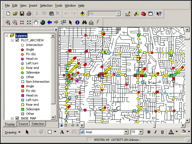
If you have the Main Module or the Collision Diagrams On GIS
Module, AIMS will display different collision types in 3 dimensions in ArcGIS
9X or later, as shown in Figure A-15B.
·
If you have the Collision Diagram Module, AIMS will display
the collision diagram in ArcGIS 9X or later, as shown in Figure A-15C.
·
If you have the Collision Diagram Roadway Layout Module,
AIMS will display the collision diagram in ArcGIS 9X or later, as shown in Figure A-15D.
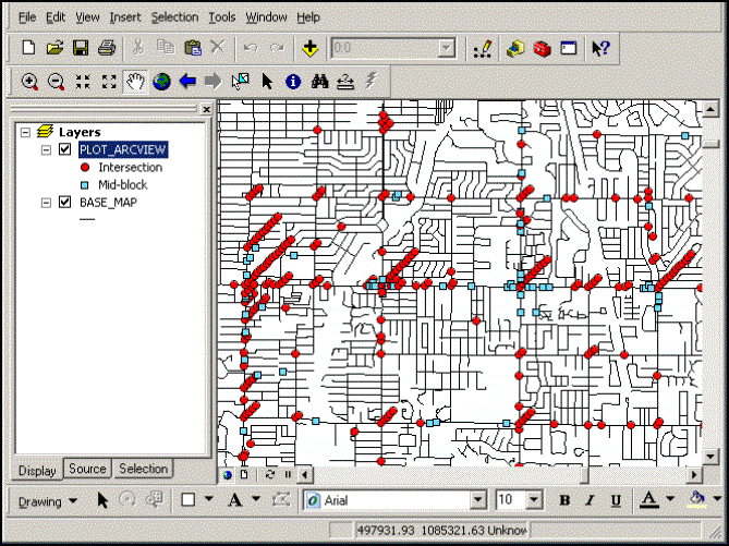
Figure A-15A: Displaying Intersection and Mid-Block Accidents In 3 Dimensions In ArcGIS
Figure
A-15B: Displaying Different Collision Types in 3 Dimensions In ArcGIS
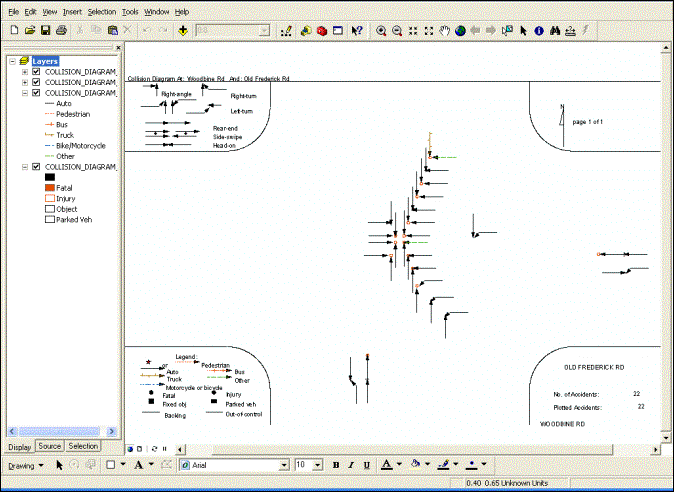
Figure A-15C: Displaying Collision Diagram In ArcGIS
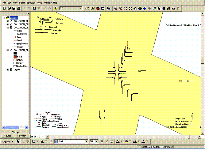
Figure A-15D: Displaying Collision Diagram With
Roadway Layout In ArcGIS
| Home AIMS AIMS-Internet About Us Contact |
| Copyright © 2023, JMW Engineering, Inc. All rights reserved. Protected by U.S. Patent 6104410 |