Aerial Photograph Module (Item# A-08)
Features:
·
It displays aerial photograph as a layer of the GIS map.
·
It adjusts the scale of each layer to be the same so that
all layers have the same spatial locations.
·
Each layer can be turned on or off. As a result, accidents
can be plotted on the map, on the aerial photograph, or on both by turning each
layer on or off.
·
You can display aerial photograph on any 3-dimensional plot
on GIS map (such as Figures A-01A to A-01D, A-11B, or A-12A to A-12B).
·
With aerial photograph, user can visually relate to the
surrounding environment.
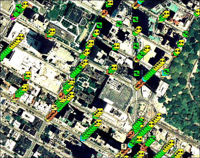
Figure
A-08: Plotting Accidents In 3 Dimensions On Aerial Photograph and On A GIS Map
|
Copyright © 2023, JMW Engineering,
Inc. All rights reserved. Protected by U.S. Patent
6104410 |