Accident Report Image Module (Item# A-11)
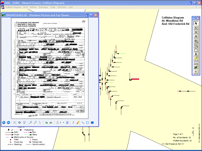
Figure A-11A: Displaying Accident Report Image By clicking A
Plotted Arrow On Collision Diagram
Features:
·
Each plotted symbol on GIS map or in collision diagram (such
as those in Figures A-01A to A-01D, A-02, A-08, A-12A to A-12B, or A-17A to
A-17D) is linked to a scanned image of the accident report.
·
When you click a plotted symbol (such as the arrow as
highlighted in red in Figure A-11A, or any symbol in Figure A-11B), AIMS will
display the scanned image of the accident report on the screen.
·
You can zoom-in the scanned image to see more details, or
print it out.
·
You can go to any page of the scanned report if it contains
several pages.
·
You can use any scanner to scan the accident reports, as
long as it can save the file in “BMP”, “JPG”, “PDF” or “TIFF” format.
·
You can save the scanned files anywhere in your computer or
network.
·
It provides archival and retrieval capabilities to manage
your crash reports.
·
Suppose you want to see all crash reports that occurred in
certain dates and times, you can do the following: a) perform a query to sort
out the crashes; b) plot the crashes on map; and c) click each plotted symbol
to view the scanned report image.
·
Suppose you want to see a crash report and the only
information you have is that it occurred in downtown in 2005 during the
afternoon. You can do the following: a) draw areas on GIS map that are
equivalent to the downtown areas, or perform a query to retrieve all crashes
that occurred in 2005 between 12 noon and 6 p.m.; b) plot the crashes on map;
c) label each plotted symbol with time; and d) click each plotted symbol that
is within downtown and with p.m. label, to view each scanned image, until the
desired one is found.
·
You do not need to finish scanning all reports in order to
use this module. You only need to provide one scanned report image to us for
setting it up. Once it has been set up, you can scan additional report images
at any time without going back to us. Any additional scanned images will be
automatically linked to their associated accident records in AIMS and will be
available for retrieval and display.
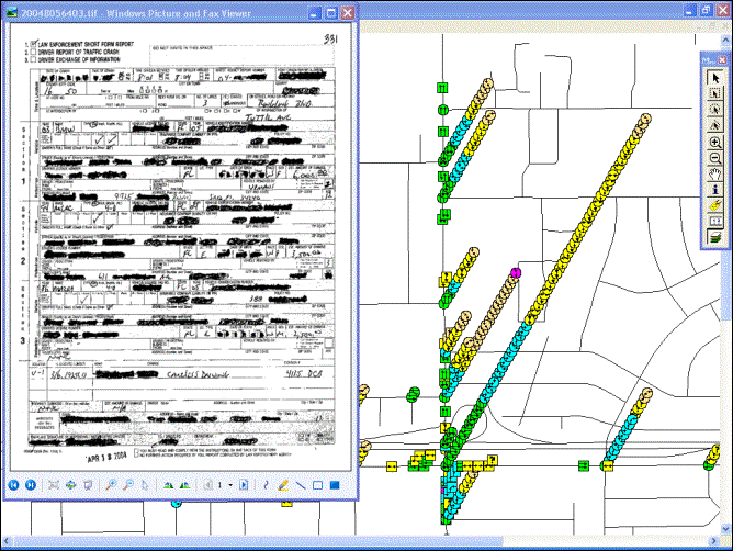
Figure A-11B: Displaying Accident Report Image By clicking A
Plotted Symbol On The GIS Map
|
Copyright © 2023, JMW Engineering,
Inc. All rights reserved. Protected by U.S. Patent
6104410 |